


If I’m being honest, backpacking The Grand Canyon of Tuolumne in Yosemite was not our favorite trip. Don’t get me wrong, it’s Yosemite, it’s gorgeous everywhere you look. The views are spectacular, the waterfalls are awe-inspiring. But there were several environmental and logistical factors that reduced our enjoyment of this hike. Some of which were our fault and could have been better planned for, and others were things outside of our control.

I’m sure most other posts you read about this hike will talk about how great it was, and I’m sure that it can be if you avoid some of the pitfalls that we did.
Trail Overview
- Distance: 29.5mi
- Type:Point to point
- Time: 2-4 days
- Elevation at trailhead: 8,600 feet
- Elevation Change: 3,500 ft
- Difficulty: Strenuous
- Crowd Factor: Moderate
- Best Time: May-June, Sept-Oct
- Permits/Fees: Yes
- Water: Yes, needs to be filtered
Highlights
|
Lowlights
|
The trailhead
There are a couple different options for hiking The Grand Canyon of Tuolumne in Yosemite.
You can do this as a thru-hike starting at either Tuolumne Meadows or White Wolf Campground.
Or you could also make it a loop by following the Ten Lakes trail back to either location.
Most people do this as a thru hike, and most people start at White Wolf and end at Tuolumne Meadows.
Pros and cons of White Wolf to Tuolumne Meadows:
- Steep 3,500ft decline over 10miles with a full pack on Day 1
- Steady but more gradual 5400ft incline over 20miles for the rest of the trek.
- Waterfalls are closer to the end of the trail with scenery getting better the further you go.
- More amenities at Tuolumne Meadow/easy to get to your car.
Pros and cons of Tuolumne Meadows to White Wolf:
- Steep 3,500ft gain over 10mi at the end of the trek, but with a more empty pack.
- Steady gradual 5400ft decline over the first 20miles.
- You’ll pass all of the waterfalls at the beginning of the trek and will be walking away from them (downstream).
- Less resources at White Wolf and harder to get to your car/transportation.
What we did
We decided to go “against the grain” and started at Tuolumne Meadows, ending at White Wolf. We did this mostly because of my husband’s knees. Steep downhill, especially when carrying the heaviest load of the trek, is tough and can cause problems for his knees. He’d rather go up steep sections than go down, so we decided to go up the steepest part of the trail, but this would also be when our packs were the lightest and planned to break it up over 2 days by camping in the middle.

Also, we’re usually the most excited about a trek and have the most energy to explore on Day 1. So starting off with all of the best scenery and waterfalls was great for us as we took more time to stop and enjoy them than we would have on Day 4 when my husband is ready to be done and just wants a shower, mattress, and real food.
If we were to do it again, I’m not sure it makes much difference either way you go. The trek from Pate Valley to White Wolf was pretty brutal. We don’t want to do that again. But then again going the other way has a lot of steep sections as well and more sun. There are just more breaks in between. I can’t say I think I’d prefer to go the other way instead.
Logistics & Transportation
Ugh, for one of the most visited National Parks, I sometimes feel like the Yosemite Park Service purposefully tries to make things extra difficult…
You are going to need to pick up your permit at the Tuolumne Wilderness Center (not to be confused with the Tuolumne Visitor’s Center which is a few miles away) either the day before or day of starting your hike.
Yosemite has recently instated a peak hour reservation system for the majority of days during the summer (which I totally get given the huge number of people going to this park), so if you want/need to pick up your permit the day before, you’ll need to make a reservation to enter the park if doing so during peak hours (5am-4pm), which you can do here. Note that you DO NOT need an additional reservation for the days covered by your wilderness permit. Your wilderness permit also acts as entry reservation for the days on your permit.
If doing this as a thru hike, there are a few options for getting where you need to go:
- Use 2 cars
- Use the YARTS bus
- Use the Tuolumne hiker’s bus
- Hitchhike
Parking
The best options for parking are: White Wolf, the Tuolumne Visitor’s center (basically across the street from Glen Aulin trailhead), along Tioga road. You can park long term along Tioga Road as long as it is open (no parking restrictions along this road, just find a spot and you’re good). Overnight parking is not permitted between October 15 and the opening of the road in spring.
Public Transportation
Now that you’ve decided where to leave your car, in order to get back to it, or to get to the trailhead, you’ll need to use public transportation. There are 2 options for this:
- Tuolumne hiker’s bus – (scroll to the bottom and click + next to Yosemite Valley to Tuolumne Meadows Hikers Bus) which stops at White Wolf as well as the Tuolumne Store and Tuolumne Lodge. But not visitor’s or wilderness centers unless you can flag down the bus to stop (if it’s not too full) or are on the bus and can request a stop. It also does not necessarily start running when Tioga Road is open. When we did our trip in July, the bus didn’t start running until Aug… brilliant. If you have questions about catching this bus, making a reservation, or when/if it’s running (like I did) call 888.413.8869.
- The YARTS bus – which is a regional bus connection Yosemite with the surrounding towns. HWY 395/YARTS395 (the green one) connects Tuolumne with the Mammoth Lakes region. It stops at White Wolf and the Tuolumne Visitors Center (but not the Wilderness center) and only runs twice a day. BUT it will only stop at White Wolf if the White Wolf campground is open, which is not guaranteed. For us, the campground was undergoing repairs, so the bus was unable to stop here.
Hitchhiking
Hitchhiking is legal in Yosemite. So if you are willing and desperate, or get stuck, you can try to hitchhike between the 2 trailheads. Honestly if you’re ever going to hitchhike anywhere, I would bet this would be one of the safest places you could probably ever do this.
Camping near the trailheads
With your wilderness permit, you can camp at a “basecamp” (assuming they are open) or one of the Yosemite backpackers’ campgrounds the night before and night after your trek.
What we did
We did our trip over July 4th and entered Yosemite the day before our wilderness/backpacking permit started. We were able to secure an entrance reservation. Both the White Wolf and Tuolumne basecamps were closed and the Tuolumne hiker’s bus was not running – so no option to camp or take a bus between the trailheads at a convenient time.
So we parked our car at White Wolf (our exit) after picking up our permit and had a reservation for the YARTS bus. BUT if the White Wolf campground isn’t open, the YARTS bus will not stop here regardless of if you have a reservation or not since there’s not enough space along the side of the road (without pulling into the parking lot) for the bus to safely stop.
Seeing the situation, we assumed the bus was not going to be able to stop here, so we walked another 1.5mi down Tioga road to the first pull-out we could find where the bus would be able to safely pull off the road and stop. When the bus came by, we jumped and waved our arms best we could to try to flag the bus down to get it to stop.
Thankfully, the driver did see us and did stop and we were able to get on the bus (remember it only runs 2x a day so if we had missed it, our trip would have been ruined). He then asked if we were supposed to be at White Wolf (based on our reservation) and explained that he wouldn’t have been able to stop there since it was closed. While this worked out, not really a great plan as he easily could have missed us and kept going.
We took the YARTS bus out of the park to Lee Vining. We spent the night at a hotel in Lee Vining that is on the YARTS route, and then took the bus back in again in the morning to the Tuolumne Visitor’s Center, which is across Tioga Rd from the Glen Aulin trailhead so that we could start our hike.
Permits
Wilderness permits in Yosemite are available on a lottery basis. You can apply to get a permit here.
You will need to know your entry trailhead and where you plan on spending the first night (you can estimate this, no one is really going to check), ideal starting dates, and how many days you need the permit for.
If you are one of the lucky ones to win the lottery, they will email you to let you know you’ve been selected.
60% of the quota is open for advanced reservations, which can be made 24 weeks in advance. If you don’t get picked in the lottery and get a permit, 40% are put available the week prior online.
Maps, Landmarks, Elevation
One of our complaints about this trek was the lack of trail maintenance. Especially between Glen Aulin and Pate Valley, and Pate Valley and White Wolf. I lost count of how many trees are downed over the trail that you have to climb over, or around, or under – taking off your pack most times in order to do it, which just exhorts extra energy.
The trail is marked and easy to follow otherwise. We were never lost or unsure of where we were going, just the tree obstacle course got really old real quick.
Trail map overview

You’re following the river for the majority of the hike, which is nice. There are a few sections that move away from the river, but it’s usually only for a short time, less than a mile or so.
Landmarks and rough distances

- White Wolf to Harden Lake Trail Junction: 4.5 mi
- Harden Lake Trail Junction to Pate Valley: 6 mi
- Pate Valley to Waterwheel Falls: 10.6 mi
- Waterwheel Falls to LeConte Falls: 1 mi
- LeConte Falls to California Falls: .75 mi
- California Falls to Glen Aulin: 1 mi
- Glen Aulin to Tuolumne Meadows: 6 mi
Elevation profile:

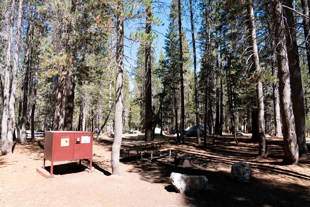
Campsites
You can basically camp anywhere you want along the trail between Glen Aulin and White Wolf. There’s no designated camping areas. You do need to follow the conditions of your Wilderness Permit which states that you have to camp 100ft away from the water. Aside from that, not really any restrictions.
The areas around Pate Valley and Glen Aulin are more established and there are lot of good spots at each, but it’s difficult to find “good” camp sites along the trail between Glen Aulin and Pate Valley.
I really like to plan ahead and know exactly where I want to camp, find the best spot with good views with the right mileage each day etc. and honestly, there’s not really the ability to do that with this one. If you’re starting to get tired and see a good spot, grab it, it might be another 2 miles before you find another option.
Especially between Glen Aulin and Pate Valley, the majority of the spaces where you could even fit a tent are in the brush just off the trail or a clearing that the trail goes directly through. There’s little to no privacy pretty much anywhere in this section where you could squeeze a tent. This was one of our complaints about this trek.
There is only one great camping spot on this trail, and that is about halfway between White Wolf and Pate Valley overlooking Hetch Hetchy. Photos of this campsite is one of the reasons I wanted to do this hike.

This campsite is located about 3mi above Pate Valley. There’s a clearing with 3-5 spots to camp while still not being directly on top of your neighbor.
If you are coming up from Pate Valley, it’s after the majority of the switch backs to get out of the valley, just after you cross the top of the waterfall – keep going maybe another 100ft and there will be some large rocks and a clearing on your right. This is where the camp site is.
If you’re coming down from White Wolf, the campsite will be on your left, after going through the meadows. The grasses will fall away and the scenery becomes more rocks. If you cross over the top of a waterfall, you’ve gone too far.
There’s also water access at this campsite – across the trail, slightly downhill from it, between 2 boulders, you can safely access the river without being too close to the edge of the waterfall. There’s enough space here to soak your feet, get water, or take a quick bird bath to cool down if you like.
I wish we hadn’t been so exhausted from the climb out of Pate Valley that we could have really enjoyed this campsite because the view really is breathtaking.
Always remember to follow the principals of leave no trace and try to camp in already established or disturbed sites.
The mistakes we made so you don’t have to
These are the main things that ruined this hike for us and made it pretty miserable. Some of them are our fault and could have been avoided with better planning, and others we couldn’t do anything about. I share them to hopefully help you avoid any similar mishaps.
Rattle snakes

I live in SoCal and had never seen a rattlesnake in my life until this trip. There were 5 of them curled up directly on the roughly 13miles of trail between Waterwheel Falls and Pate Valley. If you see one, stop, backup so that you’re outside of striking distance and if they don’t move away themselves, shoo them with a long stick or lightly toss some small stones near them to get them to move off the trail. They’re more scared of you than you are of them, don’t hurt them. And also, bring a snake bite kit just incase.
Mosquitoes and gnats
Maybe we just got unlucky, but the mosquitoes for us were absolutely relentless pretty much from Glen Aulin to Pate Valley (the lower elevations). Didn’t matter how much DEET we sprayed, if we paused to rest or take in the sights (or to get around the many downed trees), they were on us almost instantly. The gnats were also buzzing along with us on the trail. We saw several other hikers wearing mosquito netting while they hiked, which I absolutely wish we had.
Weather
When checking the weather for this trip, I stupidly looked at the weather at Tuolumne Meadows and White Wolf. The problem with that, is that the majority if this hike is 3500ft below those locations, which is roughly 12-18 degree warmer. When we did this hike, Yosemite had a heat wave, with temperatures in the Valley hitting 106. I only looked at the 80degrees of Tuolumne thinking we would be ok, but realistically once we were in the canyon, it was probably at least 100, and if we had realized that was going to be the case, we would not have done this hike.
Lack of trail maintenance

As mentioned above, there are dozens of downed trees along this trail. This was just an extra pain in the ass and annoyance on top of everything else. It zapped our energy even more every time we had to take off our packs to hop over or under, or try to find stable footing to go around etc. these tress.
What to expect along the trail
Travel Vlog
Day 1 – Tuolumne Meadows to past Waterwheel Falls
12.5mi
We started at Tuolumne Meadows, having been dropped off by the YARTS bus at the visitor’s center in the morning. We walked across the meadow, which is gorgeous, and across the footbridge, seeing a marmot playing in the stream.

We joke that we should have turned back there.
The trail is packed dirt and easy to follow. After roughly 2mi, you start a gradual decent. There are some pretty easy stream crossings and some more exposed sections across granite, but it’s all easy to follow and pretty much all downhill.
We stopped and had a snack about 3mi in next to a lake which was very picturesque.

At 4.5mi, you cross a substantial foot bridge above Tuolumne Falls, which eventually pools into Glen Aulin. After the foot bridge is a steep decent on granite stairs to get to Glen Aulin. Here you can swim in the stream below the waterfall and cool off, though it was rather populated.

We had another snack, were marauded by mosquitoes if sitting anywhere in the shade or without a breeze, and then continued on following the trail to Pate Valley to the north side of the river.

This next section of the trail is the most picturesque passing 3 more waterfalls in roughly 3 miles. This section is also one of the steepest sections expect for White Wolf to Pate Valley.

You start off in sand, and then go through a meadow and some trees before the trail descends further. The steeper sections are generally rock stairs to make the decent easier and it noticeably gets warmer and there are even more bugs as you continue down.
A lot of this section is also very exposed with little cover as you are mostly following the river, which is lined by granite rock. The sun and the elevation change here really caused me to start feeling the heat and I needed to take more breaks than normal to stay safe.

There is little to no camping spots in this section since it’s steep and there’s not really a way to get far enough from the river. But there are plenty of swim holes. We did see one establishing camping area tucked into an almost-cave in the rocks along the stairs coming down one of the steeper areas around Waterwheel Falls – we should have grabbed it.
After getting down into the canyon past Waterwheel Falls we saw the first rattle snake of the trip hanging out right on the trail. The trail here is still easy to follow (even through the downed tree obstacle course) and has transitioned now mostly to dirt.

Our initial plan was to camp shortly after Waterwheel Falls, making our first day roughly 9mi. But there was so much brush and plant life on either side in this section, we weren’t able to find an good area to camp that was not directly on the trail for about 4mi after Waterwheel Falls.
We finally found something that was the best we could do for the night, making our first day roughly 13mi. We set up camp as quickly as possible and spent the majority of our time in the tent because of the bugs.

Originally, we planned to do this hike in 4 days, but at this point, we were not having a good time decided to get it done and get out of there as fast as we could. So we ending up doing it in 2.5days instead.
Day 2 – past Waterwheel to Hetch Hetchy viewpoint
13 mi
We got up early and hit the trail by 6:30am to try to cover as much distance as we could before it got too hot.

There’s not much remarkable about this next section. The trail meanders near the river or away at some points. The trail transitions between dirt and granite rock, goes through trees (where the bugs are worse!) and through open exposed sections.
Even though you’re still descending there’s also a few sections of climbing as well. There are also a few small stream crossings, more waterfalls coming off the walls of the canyon, and a few foot bridges for crossing faster-paced streams.

We saw 4 more rattle snakes along this portion of the trail.
As you get closer to Pate Valley, the trail flattens out and is stone path along the side of the river. There are also more signs at this point directing you which way to go.

When we reached Pate Valley it was HOT, so we took a break, went in the river, had something to eat and took a nap to prepare for the start of the accent that was ahead. We also wanted to wait for the sun to move so that the majority of the accent would not be in the direct sunlight.

After crossing the foot bridge at Pate Valley, there’s about 2ish miles of walking through trees along the river before really starting the accent. Shortly after passing a natural pond full of dragonflies (go get those mosquitoes!), we trail starts to steeping increase.
We were expecting this section to be tough, but oh man, it was harder than we were prepared for. Probably because we had pushed it over past 1.5 days and were already exhausted and hot and dehydrated, but this climb was pretty brutal.

We covered roughly a mile an hour during the accent, stopping every few steps (it felt like) for a breather. Luckily, a lot of this was covered (though there are exposed sections), so we weren’t in direct sunlight for most of it.
As we climbed, the temperature slowly got cooler and the bugs finally reduced their assault. After crossing over the top of the waterfall, I was done. I couldn’t go anymore even if I wanted to, and luckily we didn’t have to.
We were aiming to make it to the Hetch Hetchy view point, and we did, and thank you to the woman who was already camping there and pointed out an opening camping spot for us and told us about the access to water across the trail. I probably would have slept directly on the trail at that point if she hadn’t pointed out that all we needed to do was look over the rocks.
Day 3 – Hetch Hetchy view point to White Wolf – 3.5mi
We started a little later than the day before having needed the rest and also being in a better elevation to avoid the crippling heat.
While the bugs were substantially less, there were still some annoying gnat that stayed with us for the rest of this trek.
From here, the trail continues to ascend further, again – you’re not done going up yet! Though not as steeply and there are some moments of reprieve with level ground.

The landscape changes to meadows with lots of really beautiful wild flowers as you get to the top of the canyon. There’s also some nice forests to provide shade, and unfortunately, more bugs if you try to rest for even 5mins. But the wildflowers were really beautiful in this section.
Hitting Harden Lake, you’re almost home free – the incline from here is much more gradual and the worst is behind you. The last mile or so to White Wolf is a wide dirt road, thankfully shaded, but still with a slight grade.

As the White Wolf Campground was closed, we had to park on Tioga Road, so the last 2mi of our hike was on the black top to get from the campground to the main road. Not the best way to end an already difficult hike.
But we made it! And we’ll never forget it!